 Transportation
Provincetown, Cape Cod's easternmost point, is approximately 112 miles from Boston.
How to get to the Lower Cape
From Boston and points north, the main route approaching the Cape is Route 3. This highway leads to the Sagamore Bridge. Travelers from the South and West access the Bourne Bridge after traveling on Route 25. Both bridges cross the Cape Cod Canal.
Ferry schedules
Door-to-door directions
Map with alternative routes
Getting around
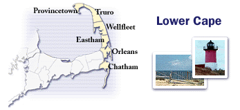
The main roadway in the Lower Cape is Route 6A. The most northerly of the Cape's three main roads, 6A follows Cape Cod Bay. Route 6 is the Mid-Cape Highway. The most southerly route along Nantucket Sound is Route 28. All three of these roads merge in the Lower Cape at the Orleans Rotary into Route 6, which travels north to Provincetown.
Map of Cape roads
Create map of specific spot
Current traffic
Conditions on Routes 3, 6, 28
Sagamore Bridge live camera
Bourne Bridge live camera
Community information links
Chatham |
Orleans |
Eastham |
Welfleet |
Truro |
PTown
|